Greetings from ORSAC family and a warm welcome to our website. The Odisha Space Applications Centre (ORSAC) was established in 1984 as an agency of Department of Science and Technology, Govt. of Odisha with the advise of Department of Space, Govt. of India to leverage emerging space technologies. ORSAC is the apex body of the state for space technology applications and its sole Nodal Agency for providing Geospatial solutions. ORSAC is repository of aerial photos, satellite images and precision geolocation information of past thirty years for the entire state.
In course of it's temporal journey during the last thirty years, ORSAC has been recognized and identified at National level as an centre of excellence for providing geospatial solutions, in both in Odisha and other states also.
Space programme in India emphasizes on implementation and application of space science and technology for the socio-economic development of the country. Use of Geostationary satellites to provide services to telecommunications, television broadcasting, weather forecasting, disaster warning and search and rescue operations; Earth Observation Satellites to provide spectral, spatial and temporal information on agriculture, water resources, urban development, mineral prospecting, environment, forestry, ocean resources, drought and flood forecasting etc. and navigation satellite system in providing geopositioning services is presently widespread and successfully implemented in our country.
ORSAC is committed to harness these emerging space borne technologies to serve the society through better management of natural resources, infrastructures and utilities providing cutting edge, as well as end to end solution using real time satellite/aerial data, Geographic Information System and Global Positioning System.
ORSAC has monumental milestones through it's involvement in developmental programmes like National Land Records Management Programme (NLRMP), Integrated Coastal Zone Management Programme (ICZMP), Natural Resources Census (NRC), Space Based Information Support for Decentralised Planning (SIS-DP), Rajiv Gandhi National Drinking Water Mission (RGNDWM), Forecasting Agricultural Output using Space, Agrometerology and Land based observations (FASAL), Natural (National) Resources Information System (NRIS) etc.
ORSAC is also the nodal centre for EDUSAT project, a satellite based communication (two way audio & video) network, that provides interactive live classroom facilities to more than two hundred High Schools of the state presently and under process of augmentation.
ORSAC is committed and determined to provide all required database for developmental planning and monitoring the progress of development from plot (cadastral) level to the state level.
I hope this website provides you ample information on our activities. For continued improvement of the website, I welcome your feedback.
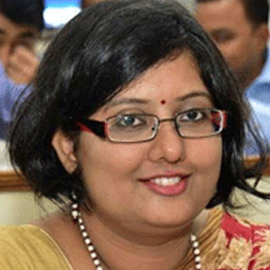
Smt. Rashmita Panda, IAS
Chief Executive
ORSAC


