The Centre has in its possession various sophisticated systems and equipments relating to Image Analysis, Photogrammetry, Cartography, Environmental Monitoring, Geophysical investigations, Soil survey and Laboratory Analysis and a wide spectrum of Satellite and Aerial Data.
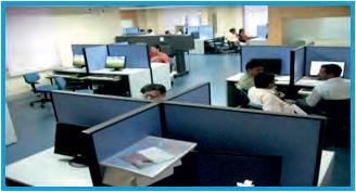
GIS AND IMAGE PROCESSING LABORATORY
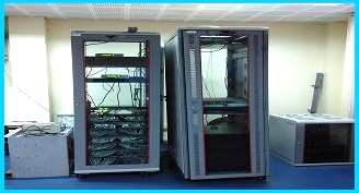
SERVER ROOM
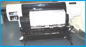
PRINTER AND PLOTTER
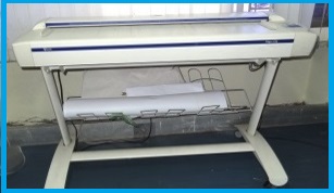
SCANNER
| Hardware | Nos |
| System | |
| Blade servers (2 x Intel Xeon Eight Core ES -2650 V2@ GHz) | 4 |
| Server - IntelP -IV Microsoft Window Server 2003 | 6 |
| High - end Workstation for Digital Photogrammetry | 4 |
| High - end Desktop with Graphics and 32" LCD Monitor | 50 |
| Pentium III | 90 |
| Pentium IV | 3 |
| Storage | |
| On - Line Storage (36 TB) with Ta pe Backup System | 1 |
| Mini - Storage attachedwith Blade servers (9TB) | 1 |
| Scanner | |
| (VIDAR) AO Size (Titan H36) (1- colour,1B&W) | 2 |
| HP - A4 size | 3 |
| Printer | |
| HP Inkjet / Deskjet - A4 | 12 |
| HP ColourLasser Jet 5550dn - A3 | 1 |
| Plotter | |
| HP Design Jet 4000 -AO (36 inch) | 1 |
| HP Design T 7100 - EAO (42 inch) | 1 |
| GPS/DGPS | |
| Hand GPS (Garmin -12) | 21 |
| Palm Top GPS /GIS | 1 |
| DGPS (Base) + ROVER (Trimble/ Leica) | 4+10 |
| ETS (TotalStation) | 2 |
| GIS | |
| Arc GIS (Workstation + Desktop) Version 10.2 | 24 |
| Auto CAD + Auto CAD Map | 1+1 |
| Terrago Geo PDF (2D & 3D) | 1 |
| Image Processing | |
| ERDAS WITH LPS (Leica Photogrammetry Suite) | 2+4 |
| ENVI/ TNT MIPS / ERDAS APOLLO (Enterprise GIS 4 Image processing SNV) | 3 |
| RDBMS (+) MS SQL 2008 (2 ) ORACLE | 1 |
| Client Supporting / CITRIX | 70 |
| Operating System (Window Vista I 7 I 2000 I 2003 I 2008 I 2012 SERVER) | |
